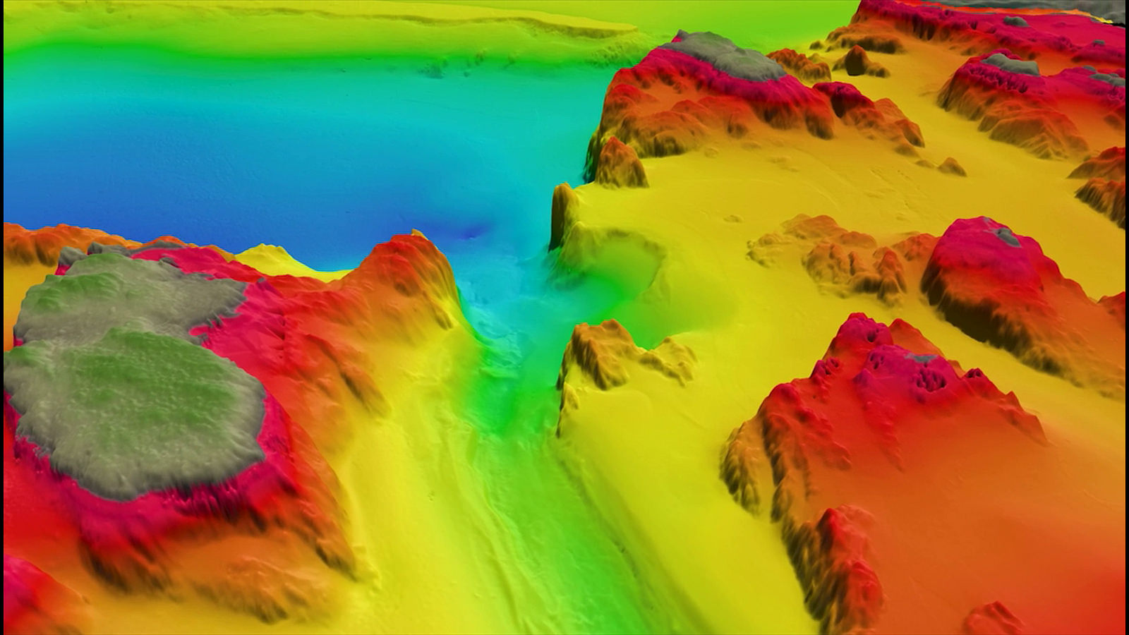
Airborne LiDAR for bathymetry – 3D layout of Lake George. The map was produced with a combination of airborne and nautical sensing, but shows the potential for LiDAR in bathymetry. Image courtesy of IBM Research.
It is a widely touted fact that humans have yet to explore 95% of the Earth’s oceans. This is because water pressure makes deeper parts of the ocean implausible to reach. Explorers also risk loss of life when sending humans on these expeditions. Airborne LiDAR scanning intends to expedite the bathymetry process.
Bathymetry is the study of ocean or lake floors, essentially it is underwater topography. Automation changes the way ocean scientists approach bathymetry, since unmanned vehicles reduce costs and risks from human involvement. In fact, scientists are developing ways to retrieve information about the ocean’s depths without submerging a vessel at all.
LiDAR sensing has been a huge boom to bathymetry, since it can capture images from a long range. LiDAR uses rapid-fire laser pulses and measures the laser’s reflection time and distance. From this data, the sensor can produce a 3D image of a target area of surface from an airborne vessel.
Advanced imaging techniques let researchers map out areas remotely, and without sending any people or equipment underwater. Thus, they completely bypass the pressure problem that limits both humans and machinery from exploring extremely deep waters. In addition, drones and other aircraft are capable of mounting LiDAR sensors, which opens a wide range of opportunities.
Different sensors for different depths
The simplest way of classifying airborne LiDAR for bathymetry is by dividing it into shallow, and deep-water sensors. Shallow areas are still exposed to light from the surface, which makes it easy to assess their conditions. Deeper areas can be more clouded with turbidity and are harder to penetrate with light.
Shallow water LiDARs usually have less powerful but more frequent laser pulses, leading to a higher resolution image. These short pulses do not have a long distance to travel and will quickly deliver the distance metric to the sensor. As the pulses fire rapidly, the sensor can produce a much higher resolution picture. Each pulse represents another detail or piece of the landscape that is put together in the final image.
There are a variety of lasers with pulse durations from 0.4 nanoseconds, to 50 ns. Short pulse lasers benefit shallow water bathymetry by providing accurate pulse duration settings even below 500 ps. The average power of a laser like this is 0.5 watts but improves with an optical amplifier, with which the amplifier is compatible.
Deep water sensors require a more powerful laser, along with a longer pulse duration as they must cross a farther distance. Distance carries with it more weakness to volatile environmental conditions that may throw off the laser’s readings. These include plant life, turbidity and turbulence.
Powerful lasers have a much longer pulse duration (7-50 ns) with an average power of 20 watts, that can reach deeper, more obstructed areas. These lasers are great for covering a wide distance but cannot provide the same resolution found in shallow water images. The size of these powerful lasers must be scaled down in order to fit the proper variations aboard a single airborne vessel.
Advantages of airborne LiDAR

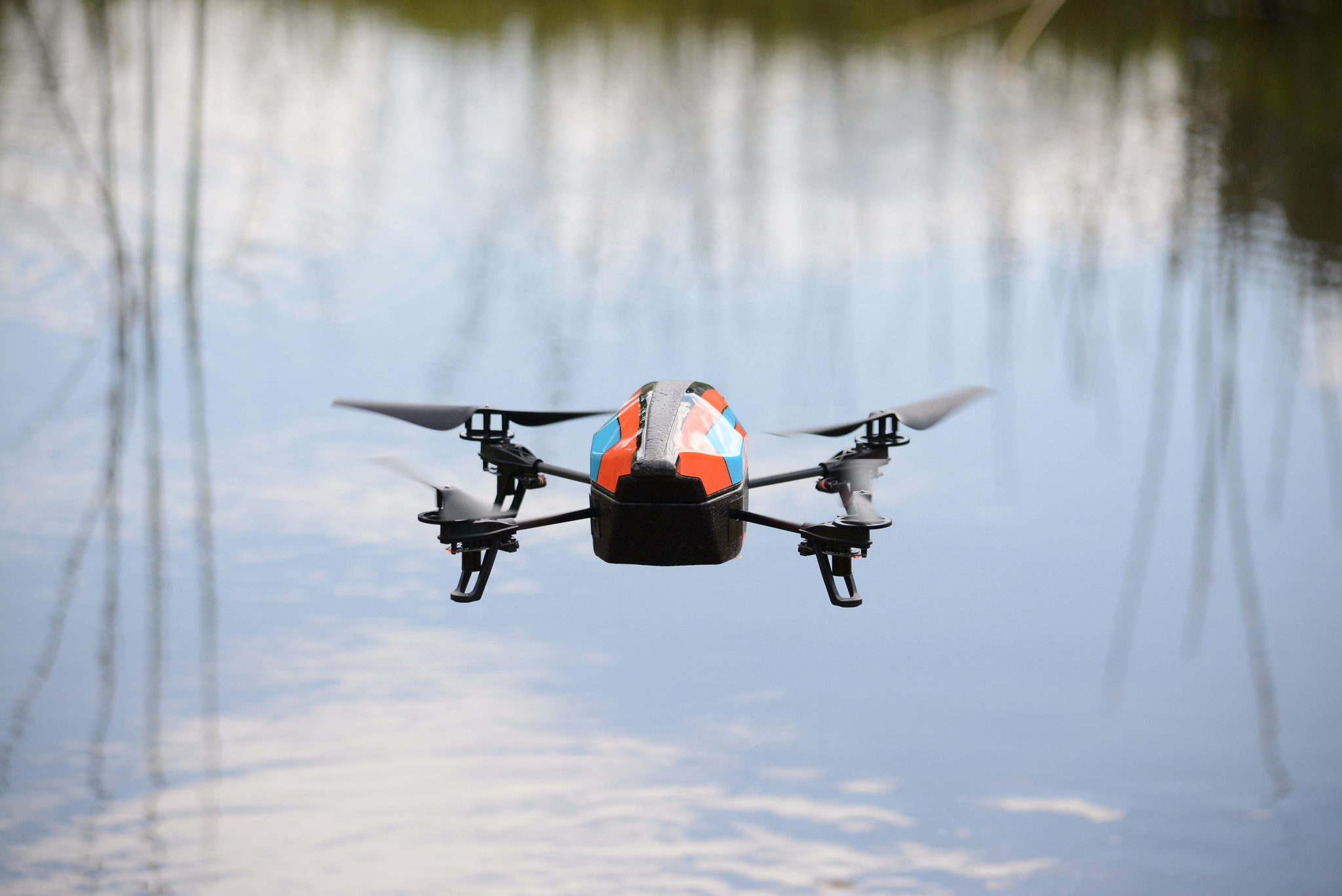
We’ve all seen some of the amazing views that drones capture while flying above hard to reach areas. As scanning technology downsizes, airborne vessels produce LiDAR images on a wide scale. Specialists hope to use aerial LiDAR to bypass nautical bathymetry altogether. Image courtesy of Luke Holmes on Flickr.
Drones (Unmanned Aerial Vehicles) are preferable due to prior use with mounted LiDAR sensors in agriculture, land surveys, weather modeling and a variety of other applications. This is especially helpful in bathymetry, as drones can cover large portions of ocean that are extremely far from land. All of this imaging is remote, with very little human involvement required.
In current manifestations, it is cumbersome and expensive to mount multiple sensors onto a single drone or plane for that matter. Once achieved, this will allow for images of varying depths, including those beyond the reach of visible light. One drone with multiple sensors will allow for a fuller, more detailed picture of a water column in one shot. Using both short and long pulse settings can compensate for the resolution loss found in larger images.
High resolution LiDAR sensing has been used successfully on a larger scale around Australia’s coasts. The test provided a detailed topography of the ocean’s surface, including coral structures. They used a manned motor glider mounted with two separate LiDARs. The glider made multiple overpasses, in which the sensors changed to different pulse settings.
While the test proves that LiDAR can map wide ranges with high efficiency, it still has some drawbacks. The sensor’s size required a larger, manned aircraft instead of an unmanned drone. In addition, the plane could not carry a full suite of various LiDAR scanners which added more time and effort to reach an accurate reading.
Conclusion
The landscapes of oceans and seas throughout the world need different bathymetry options for their differing environmental conditions. LiDAR data is still vulnerable to disruption from large amounts of turbidity, vegetation or microscopic animal life. A wide array of pulse types to choose from can provide the solution researchers need to deal with everchanging ocean conditions.
LiDAR developers are already focusing heavily on reducing the size and cost of these scanners, which will make airborne LiDAR much easier to pull off in the near future. Multiple LiDAR sensors will enable an aircraft to image deep waters over a wide range without sacrificing speed or resolution.
Humanity has a whole host of environmental problems that begin in the ocean. These include rapidly growing garbage heaps, ocean acidification and ocean “dead zones” unable to support life. Bathymetry goes beyond just exploration, and will prove more useful than ever in determining solutions for the issues that may deplete our oceans.
References: GIM International (2016) “Technology in Focus: Bathymetric LiDAR” Geomares Publishing. Accessed on: https://www.gim-international.com/content/article/technology-in-focus-bathymetric-lidar-2
Hacker, Jorg and Pfennigbauer, Martin. (2017) “Pushing LiDAR to the Limits” Geomares Publishing. Accessed on: https://www.hydro-international.com/content/article/pushing-lidar-to-the-limits
